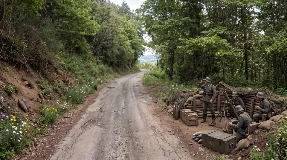
What you see is a historical visual reconstruction, based on the real stretch of the San Vito Romano–Bellegra provincial road, just before Monte Casali, at around km 1+350, made in 1993.
During the works to widen the road, while digging into the uphill embankment and along the verge on the downhill side, a large amount of wartime ordnance was found: unexploded mortar shells, some of them still gathered and stacked at the spot where a position must once have stood.
The bomb disposal experts of the Anagni unit had to be called in, and they made the devices safe and removed them. Had that not happened, those silent signs of the war would have stayed hidden in the ground, along a road we now travel almost without imagining what took place there.
In 1944, after the Allied landing at Anzio, the area of Bellegra, San Vito Romano and the surrounding territory was part of the German defensive system of the Caesar Line. Mountain roads, ridges and vantage points were strategic places of observation and defence for the Germans, allowing them to engage the Allies using those shells.
The reconstructed scene imagines one of the German positions along this provincial road: on the downhill side, an emplacement hidden among trees and earth; a mortar pointing north-west, ammunition kept in crates or stacked, men waiting. On the uphill embankment, instead, unexploded shells from the opposing front came to light.
It is not a celebration of war, but an invitation to remember.
Beneath the asphalt, among the bends and woods we now cross in a few minutes, there remain traces of hard days, of fear and destruction.
Reconstructing these places with care and realism means trying to understand our land, respecting its history and remembering how precious peace is.
The image is a reconstruction created with artificial intelligence.